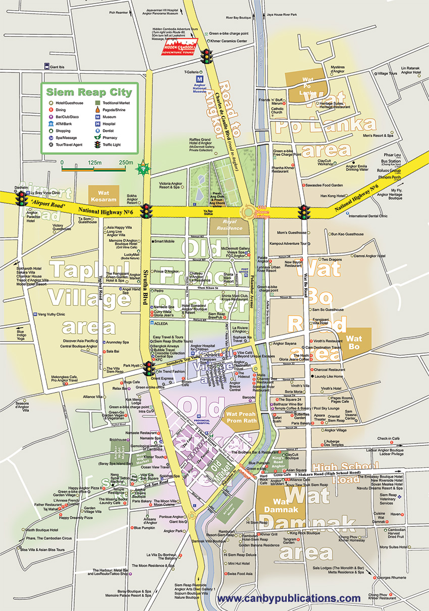
Map - Siem Reap City,
Cambodia
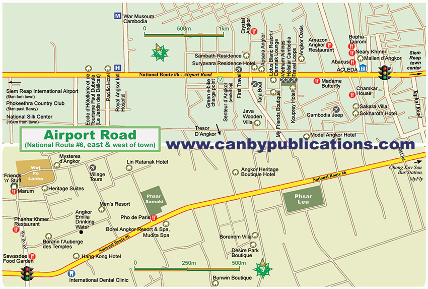
Orietation The main body of Siem Reap town stretches about 3-4 km north/south along the river and roughly 5-6 km east/west along National Highway #6. The airport is 6km and 20 minutes west of town center. The Angkor Park entrance lies 5km north of town and there are no hotels within the park. Most tourist services are in or near town and are spread relatively evenly across the area, though there are a growing number of hotels at the outskirts, often offering a more tranquil setting. In town, popular areas include: 1) the Old Market/Pub Street area is the tourist epicenter, tightly packed with restaurants, hotels and shops; 2) budget and mid-range places in the Wat Bo area, Taphul Village area and the Sok San Road area; 3) dozens of hotels along ‘Airport Road’ and the road to Angkor; 4) a large variety of mid-range hotels, restaurants and shopping lining Sivutha Blvd through town.
Map - 'Airport Road' (Ntl Hwy #6, west of town) Siem Reap,
Cambodia

|